 |
|
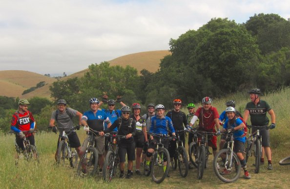
BTCEB's August Buzz . . .
|
|
|
Your Vote Counts! Get Informed!
By Austin McInerny
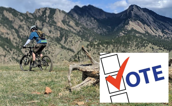 Photo courtesy Boulder Mountainbike Alliance
You may be wondering what a local election has to do with mountain biking? A LOT!
All major trail decisions on public lands managed by the East Bay Regional Park District (EBRPD), East Bay Municipal Water District (EBMUD) and the various cities within the East Bay come down to decisions made by elected officials. Every trail, every regional plan, all the funding to do maintenance, or buy parcels to allow for potential new public access – all of these things come down to choices made by our elected representatives.
As a non-profit, BTCEB can’t legally endorse candidates. However, we can work to educate voters on the beliefs and interests of candidates running for important positions within the organizations that decide where we are allowed to ride. To this end, we will be sending a questionnaire to all candidates running for office in key elections and we will share their responses to help you decide how to cast your vote in the quickly approaching elections for both EBMUD and EBRPD board of directors.
This November, we have critical decisions to make for the following offices:
East Bay Municipal Water District (EBMUD):
- Ward 1 is in Contra Costa County and includes the cities of Crockett, Hercules, Rodeo, and San Pablo; portions of Richmond and Pinole; and communities of North Richmond and Selby. Lesa McIntosh is the current board member (bio).
- Ward 5 is in Alameda County and includes the cities of Alameda and San Lorenzo; West Oakland and Oakland Airport Area; and a portion of San Leandro. Doug Linney is the current board member (bio).
- Ward 6 is in Alameda County and includes portions of Oakland (East Oakland, and south of Park Boulevard/5th Avenue) to the San Leandro City boundary. William Patterson is the current board member (bio).
As of publication of this newsletter, there are no challengers to the EBMUD incumbents which means we will need to focus our energies on educating the existing directors on the importance of improved recreational trail opportunities across EBMUD lands and the critical need to improve connectivity between EBMUD properties and adjacent lands managed by EPRPD and John Muir Land Trust, in particular, in order to expand cycling opportunities on the Bay Area Ridge Trail and other important areas.
East Bay Regional Park District (EBRPD): - Ward 1 represents the communities of Albany, Berkeley, El Cerrito, El Sobrante, Emeryville, Kensington, part of Pinole, Richmond and San Pablo. Regional Parks in Ward 1 include Tilden, and Wildcat Canyon, Brooks Island, Kennedy Grove, McLaughlin Eastshore, Miller/Knox, Point Isabel, Point Pinole, and Sobrante Ridge. Detailed map here. Elizabeth Echols is the current board member (bio).
- Ward 2 represents most of Oakland, and all of Piedmont, Canyon, Lafayette, Moraga, Orinda, Rheem Valley, Rossmoor, and part of Walnut Creek. Regional Parks in Ward 2 include a portion of Anthony Chabot, Briones, Claremont Canyon, Huckleberry, Judge John Sutter, a small portion of Las Trampas, Leona Open Space, Reinhardt Redwood, Roberts, Sibley, and Temescal. Detailed map here. Dee Rosario is the current board member (bio).
- Ward 4 represents Alameda, part of Hayward, a portion of Oakland, San Leandro, and San Lorenzo. Regional Parks in Ward 2 include a small portion of Anthony Chabot, Crown Beach, Martin Luther King, Jr., and Oyster Bay. Detailed map here. Ellen Corbett is the current board member (bio).
While currently there are no challengers to the incumbents in Wards 2 and 4, a serious battle is taking shape in Ward 1 with Norman LaForce gearing up to challenge recently appointed Director Elizabeth Echols. This race should make you very nervous as LaForce has a long track record of fighting against all proposals for increased bike access.
Obviously, there are many reasons to vote for a candidate, including the candidate’s character, perspectives and experience they might bring to their elected position. To help you decide who you want to support, we hope that all candidates that receive the BTCEB questionnaire will honestly respond in order to help us all learn what their approach to multi-use access is and how they might champion the interests of responsible off-road cyclists.
Stay tuned for a full report once we hear back from all candidates. In the meantime, we encourage you to get to know your currently elected officials and to let them know how important trail access and recreation for diverse users is to you. You can dermine who your representative is from the infographics at EBRPD and EBMUD. Crockett Hills Update
by Scott Bartlebaugh
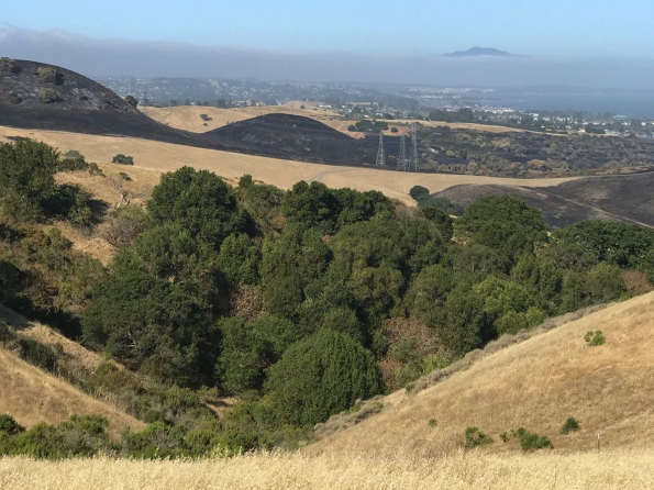 This month I met with the Crockett Hills park supervisor to discuss cattle management, trail counters, raising the priority for a Cummings Skyway trailhead, Goldfinch trail, resuming small group trail work, the park district small trail crew. The park supervisor appreciates what we do at Crockett Hills and is doing what he can to minimize cattle damage to the trails during the wet season. He's working to do maintenance on the two ponds in the top field with Soaring Eagle trail so that they are more effective for grazing (i.e. more water, less mud) to provide more flexible cattle movement. He is also acquiring machinery to provide better capability to remediate trail damage by cattle in wet weather. The plan is to minimize as much as possible the time when cattle are in fields with trails in wet weather season. Water supplies and weather predictability make this system less robust than we'd like but he is working to improve it so that cattle can be kept out of those areas longer.
The park supervisor is also working with the trails development group to get a second staging area off of the Cummings Skyway moved to a higher priority in the park district capital plan. This will be good news for those that would like to start your ride near the top of Sugar City and have easier access to Tree Frog and points south. It is currently in the plan in the 2024/25 time frame. Group trail work is on hold until Covid group restrictions loosen up.  In other news American Trails continues to have their free webinar series. Check them out if you get a chance. They record the webinars so they should be available afterward as well.

I've made some connections with the Elizabeth Echols EBRPD Ward 1 campaign. Austin's article (above) will provide extensive detail on this. Please remember this is an important access related election race. If you know voters in EBPRD Ward 1 (Berkeley to Point Pinole) we need to make sure they are informed and vote. But even if you don't live in Ward 1 this affects you.
Finally I also continued solo trail work primarily on Tree Frog in Crockett Hills this month. Some day group work will resume. Till then...
Tentative Gala Ride Dates and Locations
by Mike Udkow
Here are the expected ride dates and locations for the club gala rides for 2020:
- Sep 26 - Fernandez Ranch (JMLT)
- Oct 11 - Crockett Hills EBRP
- Nov 14 - Rockville
- Dec 12 - Deer Park
As always look for them to appear on the BTCEB Meetup Events page and here in The Buzz as the dates approach and the ride details firm up.
BTCEB Membership Drive
by Mike Udkow While membership on our Meetup site continues to grow to nearly 4,000 followers, membership in the BTCEB, your mountain biking organization, has been lagging comparatively.
To grow, to survive, and to represent the mountain biking community, we need your support. Your membership dues support our Gala rides and our RLaG program, pays for our insurance, helps to support NorCal High School MTBing and supports trail work at China Camp, Rockville, Fernandez and Crockett. We are hard at work developing the JMP Pump Track. Our Board of Directors meets bi-monthly to discuss all topics relevant to local mountain biking.
Membership levels start at $30, with a $15 student/hardship level. Lifetime membership is $500.
Aside from the dues, we truly need and value your membership.
Please join or renew today at www.btceb.orgSee you on the trails! BTCEB via Facebook
**************************************************************************************************
From the Dusty Trail . . .
Out of Town Adventures and Exploration
By Scott Bartlebaugh
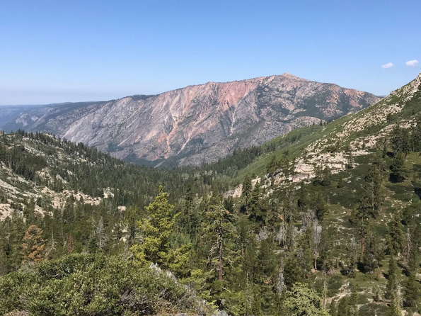 With the opening of some forest service campgrounds I took advantage to do some camping and riding somewhere besides Crockett Hills. These are a mix of places I've been going to for many years along with some exploration. I think they are all worth a look if you happen to be in the area and for me worth going to camp and ride. I gather most of my pre-ride info from TrailForks and Strava to get an idea of what might be in an area or get a track from somebody's actual ride. If you're looking for a detailed ride guide you've come to the wrong place. If you're interested in some info on a place you might like to explore you might want to read on. You won't be staying home but you'll likely be social distancing.
Hwy 108 - Pinecrest
I ride these trails from the Pinecrest campground. If you're not camping there you can come up with a little closer starting points. Pinecrest lake makes a good spot for a swim after these rides.
- Shearing Creek / Crabtree trails - There are a handful of trails around the Crabtree 04N26 and Dodge Ridge roads south of the Pinecrest lake road. These trails have been there for probably at least a decade but most haven't made it to Trailforks. They can be ridden as an out & back or paved or dirt forest roads can be used as climbing routes. The upper most trail start out at the top of the Crabtree Road at the turn west of Aspen Pack station. There's a midway entry point at the crossover road 04N06Y between the Dodge Ridge road and Crabtree at Crabtree. The bottom of the trail ends at forest road 4N68Y, the entrance road to the Cal Camp Oski just south of Meadowview campground. This lower section does make it to Trailforks and is labeled Lower Crabtree.
- South Fork of the Stanislaus river from Strawberry to Fraser Flat. On the north side of the river you'll find a singletrack that runs from just west of the Tri-dam service yard to Fraser flat with a few sections on forest road for several hundred feet. At some sections it runs along a flume that supplies water to downstream towns such as Twain Harte. On the south side of the river the trail begins west of the homes/cabins on the north side of Old Strawberry road and goes along an old rail bed to Fraser flat. These can be ridden individually as out and backs or combined into a loop. The north side trail is more technical than the south side. The southside trail shows up on Trailforks but the north side trail does not. There's a connector trail and dirt road down from Hwy 108 that starts across from the forest service office at the Hwy 108 and Pinecrest lake intersection.
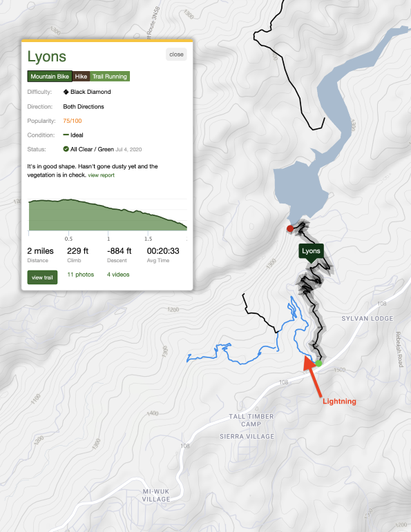
- Pinecrest Peak - This also shows up on Trailforks and can be shuttled taking forest service road 04N12 to 05N31. Pinecrest peak provides a healthy serving of granite slabs and rock rolls with some flowey sections mixed in. If not shuttling allow plenty of time as it's a long climb to reach Pinecrest Peak but you'll probably get 30 minutes or more of downhill with rocky technical change in return.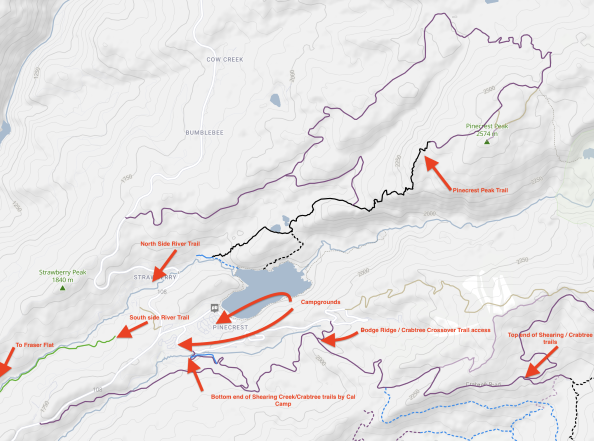 - Lyons - There's a trail system growing between Hwy 108 and Lyons Lake east and west of the Lyons Reservoir Road. There's parking along highway 108 at Lyons Reservoir Road. The Lyons trail starts just inside the gate and to the right and takes you down to Lyons Lake Dam and makes for a good out and back. Lightning starts just inside the gate and goes to the west leading to several other trails that haven't made it to Trailforks. Most of the trails have forest service signage. - Lyons - There's a trail system growing between Hwy 108 and Lyons Lake east and west of the Lyons Reservoir Road. There's parking along highway 108 at Lyons Reservoir Road. The Lyons trail starts just inside the gate and to the right and takes you down to Lyons Lake Dam and makes for a good out and back. Lightning starts just inside the gate and goes to the west leading to several other trails that haven't made it to Trailforks. Most of the trails have forest service signage.
Hwy 89 Truckee
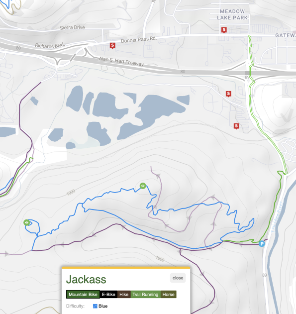
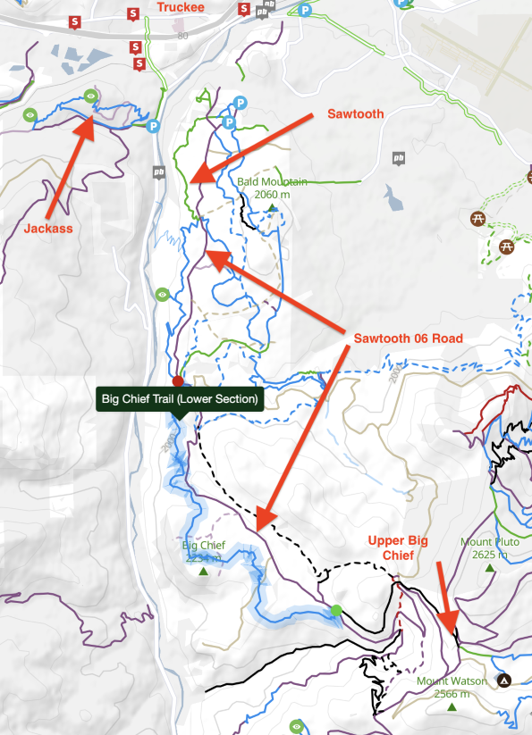
- Jackass & A-1. These are located about a mile north of the Granite Flat campground on Route 89 just south of Truckee. The Jackass trail was a social trail that was adopted by the forest service and the forest service added the A-1 trail. Jackass and A-1 should be ridden downhill and the forest service road should be used for the climb. Other social trails exist in the area that have not been adopted yet.
- Sawtooth & Big Chief - East of route 89 running north / south you can find Sawtooth and Big Chief. Sawtooth runs from the Truckee end south to meet up with Big Chief. Big Chief tops out near Watson Lake on the Fiberboard Freeway also known as Carnelian Bay Ave, Mt. Watson Road, and NFH #73 which runs west from route 267 near Brockway Summit. Forest Service road #06 or the Sawtooth road runs north south and connects up the Fiberboard Freeway and provides an alternate climbing route or loop option. Out and back or loop options can be worked out. You can also find loops starting in Tahoe City that feature Big Chief.
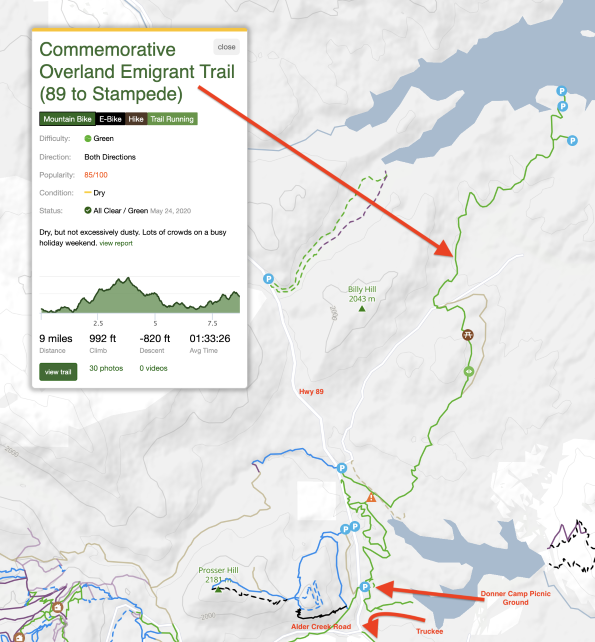
- Donner Party Camp to Stampede - This reminds me of a typical cross country route from 30 years ago. It's not highly technical and if you want to get out and cover some ground this might be the thing. It shows up as the Commemorative Overland Emmigrant Trail on Trailforks. It's not highly technical and doesn't have any extended climbs. I used the aptly named Donner Party Picnic Area and if you don't take any food on the full out and back you might be that hungry when you get back to the trail head - ta dump. The Donner Party Picnic areas is located on highway 89 a few miles north of Truckee just past Alder Creek road. There are also some trails nearby on the west side of 89 and trails extend west over to the Tahoe Donner cross country area. There's plenty to explore. A gravel bike would do alright on this route.
Hwy 4 Bear Valley / Lake Alpine
- Morgan Fletcher is plugged into the Bear Valley Trails Stewardship and touts the wares. There's plenty to check out.
- Rings/ Granite Slabs - There are 2 sections, an upper and lower to Rings. The upper section involves a hike a bike up an OHV route to reach the top end. The Bear Valley Ski Area access road route 207 can be used to access the top of Lower Rings. At the bottom of Lower Rings you can then take Power Line to Granite Slab which takes you over the Bear Valley housing area. A loop back around can be made by taking the Bear Valley to Lake Alpine trail on the south side of Hwy 4 back up. I started at the Lodgepole campground and took Lodgepole trail over to the OHV route out of the Sno Park lot. Parking at the Bear Valley housing area would make a good staging point.
- Corral Hollow / Elusive / Thor / Loki - Starting from the Bear Valley housing area head west on the frontage round on the north side of Hwy 4 to the Corral Hollow OHV road. Signage is good for the OHV road and the road was a nice climb for most of it. A few miles up you'll see forest service signage for a single track on the left at the bottom of Elusive trail. If you take the OHV road to the top and then head west you'll reach the top of Elusive trail. You'll most likely have a section of hike a bike on the upper part of the OHV climb past the bottom of Elusive. Elusive tends to be loose and somewhat steep but it grew on me the further it went. If you're not interested in climbing to the top of the ridge then watch for an unmarked single track to your right a few hundred feet further up the OHV climb past the bottom of Elusive. This is Moondust and heads over to Loki and Thor. From hear continue own and explore. Vern at the bike shop gave me the directions to get out here and after several loops through I don't think I found all of Loki and Thor but what I did find was some good steep granite rolls and some granite slabs mixed in with some forested singletrack. It was good stuff even if I didn't know what I was on exactly or it's name. The locals ride at Wednesday at 5pm and Sundays at 10am per Vern and they don't mind showing folks around. Elusive shows up on Trailforks but Thor and Loki haven't.
- Lake Alpine Loop / Cape Horn - There's a loop around Lake Alpine and a side trail you can out and back to Cape Horn. The south side of Lake Alpine had some hike a bike rock gardens based on my crap skillset but outside of that and the last bit of climb to Cape Horn the vast majority was rideable. You can find all this on Trailforks. 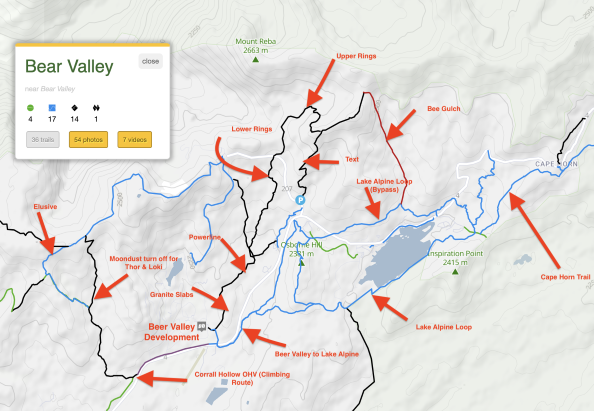
Get Lost. Seek out Type-2 fun. Happy Trails!
MCBC DIRT FONDO GOES VIRTUAL!
by MCBC SIGNATURE EVENTS
DIRT FONDO TRANSITIONS TO A VIRTUAL FORMAT THIS SUMMER!
Due to a spike in cases of the coronavirus, the COVID-19 Marin County Health Order limits permitted activities to groups of 12 or less, which forces us to move the 2020 Dirt Fondo to a virtual format. You will receive a package in the mail the first week of August and have 20 days (AUGUST 10 thru 30, 2020) to complete the ride with your family of close friends. This year’s route will start and end in downtown Mill Valley and include some of the best segments of the traditional Dirt Fondo route. Register Now!
Ride on the Wild Side
by Austin McInerny
Photo by Karl Nielsen
This month’s featured ride combines both Sibley Volcanic Regional Preserve and the newly renamed Reinhardt Redwood Regional Park and provides opportunities to view an ancient volcano, enjoy great sections of the Bay Area Ridge Trail, learn about native fishes, and get a solid workout in less than 16 miles with just over 2,000’ of climbing. I recommend two water bottles, some tasty snacks and a functioning bike bell to alert other trails users of your approach as you are likely to see a lot of people if you do this ride during peak weekend and afternoon hours. For this reason, I prefer to do this ride early in the morning and, ideally, on weekdays.
  While I ride from my home in central Berkeley, the route map shows the ride as beginning from the Sibley Preserve staging area where you will immediately descend on the Bay Area Ridge Trail towards Highway 24 on a fast and fun downhill on which you need to be careful as you might encounter hikers and horses around some blind turns. At the bottom, you will pass thru a gate and stay to your right to climb back up Quarry Road for a bit before hitting the dirt Volcanic Trail for the climb back up to the top where you can check-out the interior of the extinct Round top Volcano from the overlook into the quarry where basalt lava was removed. Note: as a result of BTCEB advocacy efforts, a connection from this spot down to the new McCosker Ranch Park off of Pinehurst Road). Take the Round Top Loop Trail back to the staging area where you started and south down Skyline Blvd to the Skyline Gate at Redwood Regional Park. Along the way you will pass Huckleberry Botanic Regional Preserve which is off limits to bikes, but makes for great hiking.
Take the West Ridge Trail from the parking lot south towards the Moon Gate and stay on West Ridge to pass underneath the Chabot Space & Science Center (sadly closed due to the pandemic) into the Redwood Bowl where you will be surrounded by amazing trees. Stay on West Ridge Trail and enjoy this East Bay classic rolling descent along the Bay Area Ridge Trail which gets pretty sketchy in the last chicane section before you bottom out at mile #9 of the ride.
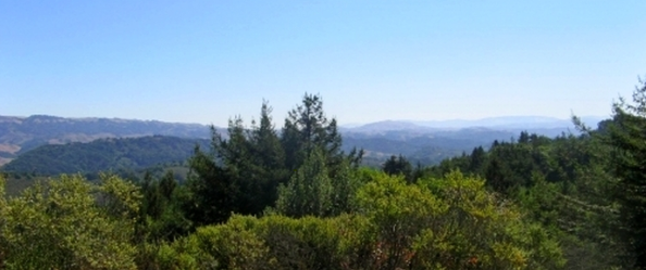 Panoramic View of West Ridge Trail Panoramic View of West Ridge Trail
Be REALLY careful as this last descent has sent many to the hospital and there may be uphill traffic. GO SLOW and IN CONTROL. Be sure to check-out the Historical Landmark #970 located at the fishway interpretive site a short distance inside the park's Redwood Gate park entrance off Redwood Road before making the climb up Canyon Trail to take East Ridge Trail for around 3 miles back to the Skyline Gate.
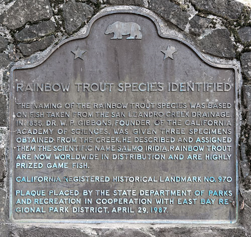
The naming of the rainbow trout species was based on fish taken from the San Leandro Creek drainage, which includes Redwood Creek. Trout rarely seen in the creek today are descendants of that pure strain. After the rolling climb back to the parking lot, which affords great views off to your left, take Skyline Boulevard back to the start.
Be sure to watch this short video detailing the history of Redwood Park before hitting the trails and please send feedback and/or suggestions for other trails to feature in the future to advocacy@btceb.org
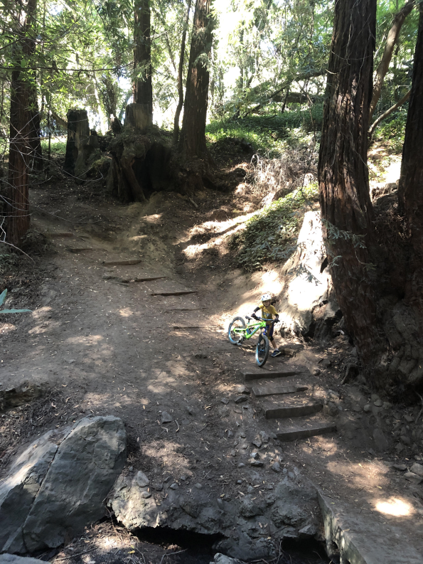
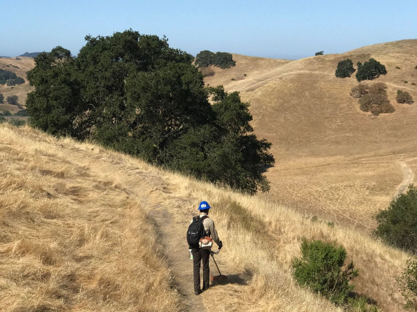
Fringe Rider
by John Roberts
Emilio decides to play it safe with his Spawn 24There are a lot of good rides out there. These days, with Covid, we have to be more selective. The regular parks are packed. The popular trails are, populated. Alternative fringe areas have to be considered. This includes less traditional parks such as Fernandez Ranch. Or even better are connector canyons such Sausal Creek (pictured) which offer families alternatives to driving. And with the spate of recent car break-ins is just another reason why riding to parks may be best. Pedaling Forward Against COVID-19
by Cycles of Change 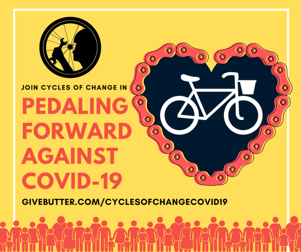 How can you help? You can strengthen our current fundraising campaign by sharing our Givebutter Fundraising page with friends, family, co-workers, and your religious community, and making an additional donation. Every donation from $10 dollars and beyond ensures communities that stand the most to gain don’t get left behind with a flat tire. How can you help? You can strengthen our current fundraising campaign by sharing our Givebutter Fundraising page with friends, family, co-workers, and your religious community, and making an additional donation. Every donation from $10 dollars and beyond ensures communities that stand the most to gain don’t get left behind with a flat tire.Fund New Trails. Win a Dream Bike!
By Access4Bikes
.jpg) Every $5 you donate enters you in a chance to win this ultra-rare S-Works Turbo Levo SL Founder’s Edition* courtesy of Specialized. The more you donate, the more chances you have to win. Enter to win here!
Every Cent of Your Donation Counts!
Perhaps more than ever, we now appreciate our open spaces in ways we never have before. Access4Bikes (A4B) is donating 75% of the proceeds raised by this giveaway directly to funding mountain bike trails in Marin. Not salaries (there aren't any A4B salaries anyway). Not BBQ’s. Not vacations. Just more trails. Marin land managers have asked us to come up with funds to help close the gap on important connectors like Easy Grade and Liberty Gulch and we are responding.
The remaining 25% of the proceeds will go to the California Mountain Bike Coalition (CAMTB) to help get this very important group off the ground. Mountain bike advocacy has to happen on all levels, and when IMBA left California in 2017 we were left with a state-wide void. CAMTB is filling that void, and your donation helps!
The winner will be chosen on September 12, so don't slack!
ENTER TO WIN NOW!
------
Reminder: As a BTCEB member, you can receive a 10 percent or higher discount for parts at many of the bike shops in the East Bay. You just have to ask. Thank you to the many bike shop sponsors for your support!
****************************************************************************************** |
|
|
|
|
|
ABOUT BTCEB
BTCEB is a one-stop shop. We defend access rights. We lead volunteers to build sustainable trails and repair historic trails. We host social rides. We teach underprivileged kids to ride. We fund youth mountain bike race teams. The list goes on because as riders we can do more together than individually. If you have not already, please consider joining us as a member. Many bike shops in the East Bay grant a 10% discount on bike parts to BTCEB Membership Card holders. It is just another benefit of joining BTCEB. Thank you to all the East Bay bike shops that support our efforts both on and off the trails!
CONTACT US
Do you have a good ride story, trailwork report, or other bike trail news? Tell us about it. Please send a paragraph with 150 words or less with a pic (under 10MB please) and/or link telling us about trailwork, rides, events, or any good mountain bike effort to bring our community together, etc. Please send via email to our editor Jamuel Starkey (with pictures if possible) at: buzz@btceb.org
BTCEB BOARD MEMBERS Jerott King, Presidentinfo@btceb.orgJon Running, Membership Directormembership@btceb.orgYvette Skinner, Vice President
Tom Holub, Secretary
Alan Enrici, Treasurer
Austin McInerny, Advocacy Director
Ben Brunetti, Trails Director
Josh Church, Education and Promotion Director
Jamuel Starkey, Communications DirectorTom Gandesbery, Director-at-Large
Scott Bartlebaugh, Director-at-Large |
|
|
|
|
|
|
|
.png)